
Preview
Johnson's Bibliographic Reference
1864-76
Creation Date
1864
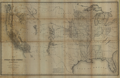
Description
Map constructed from the Public Surveys and other official sources in the General Land Office, drawn by J.H. Hawes, Principal Draughtsman, T. Franks, Assistant.
Public lands in the states are overlain with the Public Land Survey System grid which divides lands into 6-mile square townships, ranges, and sections. In surveying the Public Lands the U.S. Bureau of Land Management surveyed 1.8 billion acres.